 Il Ponte Casa d'Aste - Palazzo Crivelli - Via Pontaccio 12, 20121 Milano
LIBRI E MANOSCRITTI Libri e Manoscritti
martedì 24 settembre 2019 ore 15:00 (UTC +01:00)
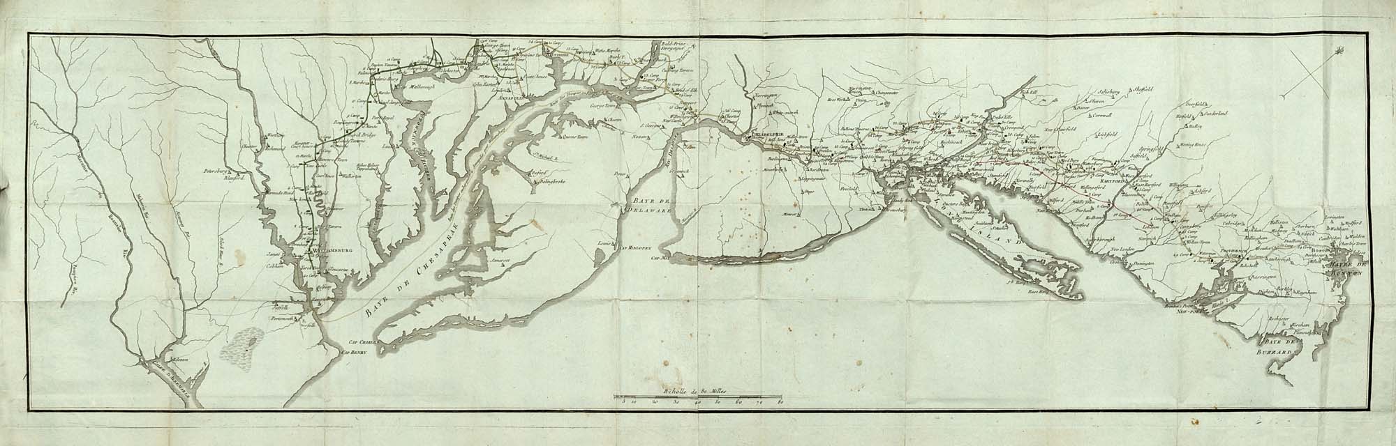
SOULES, François (1748-1809) - Histoire des troubles de l'Amérique anglaise, éc
SOULES, François (1748-1809) - Histoire des troubles de l'Amérique anglaise, écrite sur les mémoires les plus authentiques. Parigi: Buisson, 1787.Seconda edizione aumentata, esemplare in brossura coeva e in barbe completo delle 3 carte geografiche che illustrano alcuni dei territori dell'America del Nord. L'opera si occupa del periodo tra il 1768 e il 1783 e della firma del trattato di Parigi.4 volumi, 8vo (210 x 132mm). Occhielli, 3 grandi mappe ripiegate dell'America, entrambe le mappe di Long Island e del Delaware e di Chesapeake Bay su carta azzurra e in parte colorate a mano; sono delineati i territori dell'America Settentrionale inclusa la zona di New York; con pagine pubblicitarie solo alla fine del vol. I ed errata alla fine del volumi II, III e IV (alcune bruniture, fioriture e piccoli strappi marginali al testo e piccoli difetti alle mappe). Brossura coeva, titolo su etichetta al dorso (un po' di perdite, pieghe e strappi). A causa del diverso numero di pagine pubblicitarie riscontrato in altre copie il lotto è venduto come da esaminare e non è passibile di storno. (4)-ENSOULES, François (1748-1809) - Histoire des troubles de l'Amérique anglaise, écrite sur les mémoires les plus authentiques. Paris: Buisson, 1787.Second, enlarged edition. This work covers the period from 1768 to 1783 and the signing of the treaty at Paris. The large map is a handsome rendering of the eastern and southern United States northwards through a good part of Canada. On the Plan d'York en Virginie, avec les attaques et le campemens de l'armée combinée de France et d'Amérique a number of those locations are coloured by hand.4 volumes, 8vo (210 x 132mm). Half-titles, 3 large engraved folding maps, both the maps of Long Island and Delaware and Chesapeake Bays on blue paper and partially hand-coloured, with advertising leaves at end of vol. I and errata at end of vols. II, III and IV (some browning, spotting and small marginal tears to text, some light wear to maps). Contemporary wrappers, title on spine label (some chipping, creases and tears). Due to the variant number of advertising leaves found in other copies the lot is sold as viewed and is not subject to return. (4)